Nguồn Cây

Đã đối chiếu nguồn Cây cảnh & hoa
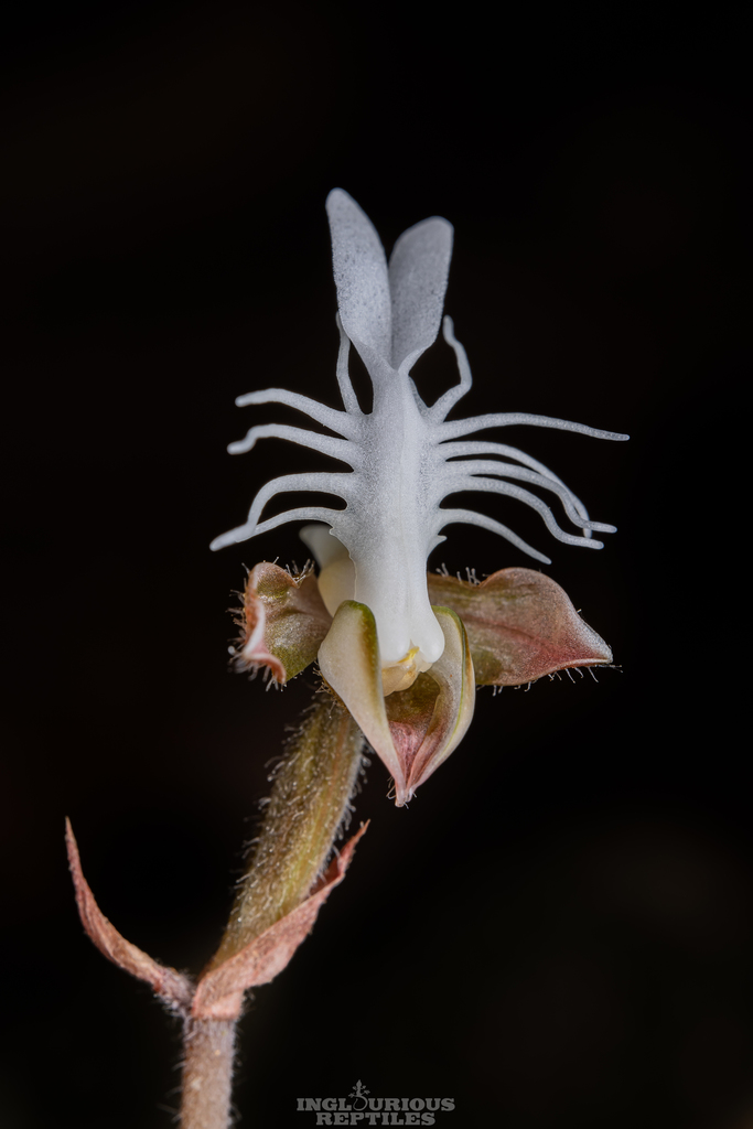
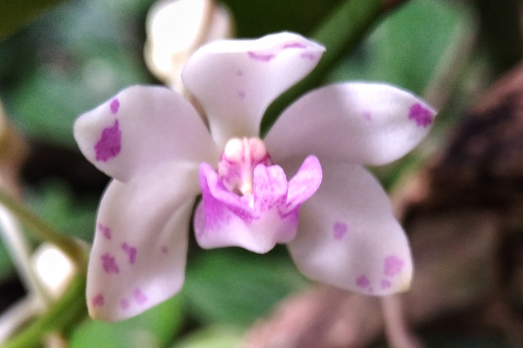
Coelogyne roseans
Coelogyne roseans
Tên gọi khác: Coelogyne (Coelogyne roseans)
1. Định danh phân loại học theo GBIF
- Danh pháp khoa học chuẩn: Coelogyne roseans (Schltr.) R.Rice
- Tên chấp nhận (Accepted Name): Coelogyne roseans (Schltr.) R.Rice (Tình trạng danh pháp: ACCEPTED)
- Bậc phân loại: SPECIES
- Hệ thống phân loại học 7 cấp: Giới Plantae → Ngành Tracheophyta → Lớp Liliopsida → Bộ Asparagales → Họ Orchidaceae → Chi Coelogyne.
- Mã định danh dữ liệu GBIF (SpeciesKey): 11094086
2. Dữ liệu quan trắc & Phân bố thực địa tại Việt Nam
- Tổng số mẫu vật / ghi nhận thực địa tại VN: 19 bản ghi.
- Tỉnh thành có mẫu vật thực tế: Ha Giang, Bac Kan, Thanh Hoa, Lang Son, Cao Bang.
- Địa bàn & Sinh cảnh thu thập tiêu biểu: Bac Me Distr., Phieng Luong Municipality, about 1.5 km to SW of Phieng Luong Municipality headquarters. Heavily logged primary closed evergreen broad-leaved forest on slopes and tops of mountains composed with solid highly eroded crystalline limestone.; Na Ri District; An Tinh Township and Community, Na Duóng Village; Kim Hy National Protected Area. Collections along second ridge E of main road through village; in mostly secondary, dry, broadleaved, evergreen forest on limestone; on sometimes sheer to very steep E-facing to SE-facing slope on hard, highly eroded, marble-like limestone (karst). 2 localities for GPS. Collections between 22.13.03 N, 106.04.2 at 723m elevation and 22.13.01 N, 106.04 E at 754m elevation. Collected with N.T. Hiep, L.V. Averyanov, B. Hall & N.Q. Hung.; Cho Dan Distr., Ban Thi Municipality, Cho Dien village, Then Su mt.; Quan Ba District; Bat Dai Son Municipality; Bat Dai Son Provincial Protected Area (2000). On limestone ridge of degraded forest just northwest of Bai Dai Son border station; collections in forest above cultivations (Forest possibly burned ca. 25 years ago or so, only small trees and few fire tolerant herbs).; Vi Xuyen District; Phong Quang Municipality; Man Village. Limestone peaks and ridges NE of Village.; Ba Thuoc Distr., Eo Dieu Municipality, territory of Pu Luong protected area, near Eo Dieu Village. Primary wet coniferous forest with Pinus kwangtungensis along tops of remnant highly eroded karst limestone..
- Độ cao phân bố ghi nhận: 300m – 1500m so với mực nước biển.
- Thời gian thu thập ghi nhận: 1997 – 2005.
- Nhà khoa học / Chuyên gia khảo sát: L. V. Averyanov|Phan Ke Loc|N.T. Vinh|A. Averyanova, Daniel K. Harder|et al., Phan Ke Loc|et al., Daniel K. Harder|T. H. Nguyên|Phan Ke Loc|L. V. Averyanov|George E. Schatz|Sharon A. Bodine, Daniel K. Harder|Phan Ke Loc|L. V. Averyanov|George E. Schatz|Sharon A. Bodine, T. H. Nguyên|L. V. Averyanov|Phan Ke Loc.
3. Viện bảo tàng & Bộ sưu tập tiêu bản lưu trữ
- Cơ quan & Bộ sưu tập tiêu bản: Tropicos.
- Giá trị học thuật: Dữ liệu mẫu vật tiêu bản được thẩm định khoa học và lưu trữ phục vụ nghiên cứu hệ thực vật bản địa, kiểm kê đa dạng sinh học và bảo tồn nguồn gen thực vật tại Việt Nam.
Công dụng
- Ghi nhận chính thức trong cơ sở dữ liệu đa dạng sinh học GBIF với 19 bản ghi tại Việt Nam
- Mẫu vật tiêu bản lưu trữ tại: Tropicos
- Có giá trị phân loại học, kiểm kê hệ thực vật bản địa và nghiên cứu bảo tồn nguồn gen
Hướng dẫn chăm sóc
Việt Nam
- Ánh sáng
- Ánh sáng tự nhiên theo tầng tán rừng hoặc thảm thực vật bản địa tại các điểm khảo sát.
- Tưới nước
- Phụ thuộc vào ẩm độ và chế độ mưa tự nhiên của khu vực phân bố mẫu vật.
- Đất trồng
- Sinh cảnh tự nhiên ghi nhận thực tế: Bac Me Distr., Phieng Luong Municipality, about 1.5 km to SW of Phieng Luong Municipality headquarters. Heavily logged primary closed evergreen broad-leaved forest on slopes and tops of mountains composed with solid highly eroded crystalline limestone.; Na Ri District; An Tinh Township and Community, Na Duóng Village; Kim Hy National Protected Area. Collections along second ridge E of main road through village; in mostly secondary, dry, broadleaved, evergreen forest on limestone; on sometimes sheer to very steep E-facing to SE-facing slope on hard, highly eroded, marble-like limestone (karst). 2 localities for GPS. Collections between 22.13.03 N, 106.04.2 at 723m elevation and 22.13.01 N, 106.04 E at 754m elevation. Collected with N.T. Hiep, L.V. Averyanov, B. Hall & N.Q. Hung.; Cho Dan Distr., Ban Thi Municipality, Cho Dien village, Then Su mt.; Quan Ba District; Bat Dai Son Municipality; Bat Dai Son Provincial Protected Area (2000). On limestone ridge of degraded forest just northwest of Bai Dai Son border station; collections in forest above cultivations (Forest possibly burned ca. 25 years ago or so, only small trees and few fire tolerant herbs).; Vi Xuyen District; Phong Quang Municipality; Man Village. Limestone peaks and ridges NE of Village.; Ba Thuoc Distr., Eo Dieu Municipality, territory of Pu Luong protected area, near Eo Dieu Village. Primary wet coniferous forest with Pinus kwangtungensis along tops of remnant highly eroded karst limestone..
- Bón phân
- Sinh trưởng tự nhiên trong thảm thực vật hoang dã; không áp dụng phân bón nông nghiệp.
- Nhân giống
- Tái sinh tự nhiên bằng hạt, bào tử hoặc chồi sinh dưỡng trong sinh cảnh hoang dã.
- Thu hoạch
- Không khai thác thương phẩm; phục vụ nghiên cứu khoa học và bảo tồn đa dạng sinh học.
Miền Bắc
- Ánh sáng
- Ánh sáng tự nhiên theo tầng thảm thực vật tại Miền Bắc.
- Tưới nước
- Chế độ ẩm và lượng mưa tự nhiên của vùng sinh thái Miền Bắc.
- Đất trồng
- Sinh cảnh thực tế thu thập mẫu tại Miền Bắc: Bac Me Distr., Phieng Luong Municipality, about 1.5 km to SW of Phieng Luong Municipality headquarters. Heavily logged primary closed evergreen broad-leaved forest on slopes and tops of mountains composed with solid highly eroded crystalline limestone., Cho Dan Distr., Ban Thi Municipality, Cho Dien village, Then Su mt., Quan Ba District; Bat Dai Son Municipality; Bat Dai Son Provincial Protected Area (2000). On limestone ridge of degraded forest just northwest of Bai Dai Son border station; collections in forest above cultivations (Forest possibly burned ca. 25 years ago or so, only small trees and few fire tolerant herbs)., Vi Xuyen District; Phong Quang Municipality; Man Village. Limestone peaks and ridges NE of Village., Quang Ba District; at Sin Suoi Ho village and river., Quang Ba District, Bat Dai Son..
- Bón phân
- Cây sinh trưởng tự nhiên trong sinh cảnh bản địa, không dùng phân bón.
- Nhân giống
- Tái sinh tự nhiên theo loài.
- Thu hoạch
- Mẫu vật nghiên cứu tiêu bản khoa học; không khai thác bừa bãi.
Miền Trung
- Ánh sáng
- Ánh sáng tự nhiên theo tầng thảm thực vật tại Miền Trung.
- Tưới nước
- Chế độ ẩm và lượng mưa tự nhiên của vùng sinh thái Miền Trung.
- Đất trồng
- Sinh cảnh thực tế thu thập mẫu tại Miền Trung: Ba Thuoc Distr., Eo Dieu Municipality, territory of Pu Luong protected area, near Eo Dieu Village. Primary wet coniferous forest with Pinus kwangtungensis along tops of remnant highly eroded karst limestone..
- Bón phân
- Cây sinh trưởng tự nhiên trong sinh cảnh bản địa, không dùng phân bón.
- Nhân giống
- Tái sinh tự nhiên theo loài.
- Thu hoạch
- Mẫu vật nghiên cứu tiêu bản khoa học; không khai thác bừa bãi.
Nguồn tham khảo
1. Global Biodiversity Information Facility (GBIF)
GBIF Occurrence Records: Coelogyne roseans (Schltr.) R.Rice in Vietnam (19 occurrences).
Giấy phép: CC BY 4.0
2. Tropicos
Mẫu vật lưu trữ tại: Tropicos.
Giấy phép: GBIF Contributor Dataset
Trích dẫn trang này
Coelogyne roseans (Coelogyne roseans). Kho thực vật Việt Nam — Nguồn Cây. https://nguoncay.com/kien-thuc-cay-trong/coelogyne-coelogyne-roseans (truy cập 21/10/2026).